Get the latest financial news, insights and expert analysis from our award-winning MoneyWeek team, to help you understand what really matters when it comes to your finances.
You are now subscribed
Your newsletter sign-up was successful
Want to add more newsletters?

Twice daily
MoneyWeek
Get the latest financial news, insights and expert analysis from our award-winning MoneyWeek team, to help you understand what really matters when it comes to your finances.

Four times a week
Look After My Bills
Sign up to our free money-saving newsletter, filled with the latest news and expert advice to help you find the best tips and deals for managing your bills. Start saving today!
These days, satellite navigation systems are everywhere. Even the meanest smartphone can be used to guide you to your destination. Type in where you want to go, switch off brain, and follow the arrows. Only losers and old people use maps these days.
Satnavs aren't perfect, of course. They can cause irritation to residents when their normally quiet streets get marked as a handy shortcut for unsuitably large lorries. And they regularly cause hilarity when we hear of another inattentive fool who's driven into a river or off a cliff because that's what the satnav told them to do.
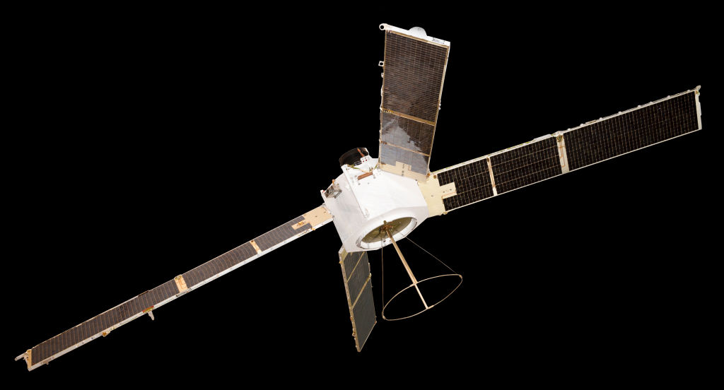
And the whole thing began on this day in 1960 when Nasa sent the Transit 1B satellite into orbit. The satellite was designed to provide positioning for the US Navy's fleet of Polaris ballistic missile submarines, a task it performed for over 30 years. It was superseded by America's Global Positioning System, the GPS known and loved by smartphone users the world over.
MoneyWeek
Subscribe to MoneyWeek today and get your first six magazine issues absolutely FREE

Sign up to Money Morning
Don't miss the latest investment and personal finances news, market analysis, plus money-saving tips with our free twice-daily newsletter
Don't miss the latest investment and personal finances news, market analysis, plus money-saving tips with our free twice-daily newsletter
But GPS isn't the only system in town. The Soviet Union launched its Glonass system in the late 1960s. Now run by Russia's armed forces, it was the second system to achieve whole earth coverage.
China's BeiDou system has been operating since 2000. And India has its IRNSS, which provides coverage over the sub-continent. The EU isn't being left behind either – it has its Galileo system, in which the UK, having spent around £10 billion on it, is no longer involved.
Get the latest financial news, insights and expert analysis from our award-winning MoneyWeek team, to help you understand what really matters when it comes to your finances.

-
 Pension Credit: should the mixed-age couples rule be scrapped?
The mixed-age couples rule was introduced in May 2019 to reserve pension credit for older households but a charity warns it is unfair
-
 Average income tax by area: The parts of the UK paying the most tax mapped
The UK’s total income tax bill was £240.7 billion 2022/23, but the tax burden is not spread equally around the country. We look at the towns and boroughs that have the highest average income tax bill.
-
 31 August 1957: the Federation of Malaya declares independence from the UK
Features On this day in 1957, after ten years of preparation, the Federation of Malaya became an independent nation.
-
 9 April 1838: National Gallery opens in Trafalgar Square
Features On this day in 1838, William Wilkins’ new National Gallery building in Trafalgar Square opened to the public.
-
3 March 1962: British Antarctic Territory is created
Features On this day in 1962, Britain formed the British Antarctic Territory administered from the Falkland Islands.
-
10 March 2000: the dotcom bubble peaks
Features Tech mania fanned by the dawning of the internet age inflated the dotcom bubble to maximum extent, on this day in 2000.
-
9 March 1776: Adam Smith publishes 'The Wealth of Nations'
Features On this day in 1776, Adam Smith, the “father of modern economics”, published his hugely influential book The Wealth of Nations.
-
 8 March 1817: the New York Stock Exchange is formed
Features On this day in 1817, a group of brokers moved out of a New York coffee house to form what would become the biggest stock exchange in the world.
-
7 March 1969: Queen Elizabeth II officially opens the Victoria Line
Features On this day in 1969, Queen Elizabeth II took only her second trip on the tube to officially open the underground’s newest line – the Victoria Line.
-
4 March 1519: Hernan Cortes arrives in Mexico
Features On this day in 1519, Hernan Cortes landed in Mexico before marching on the Aztec capital, Tenochtitlan.
